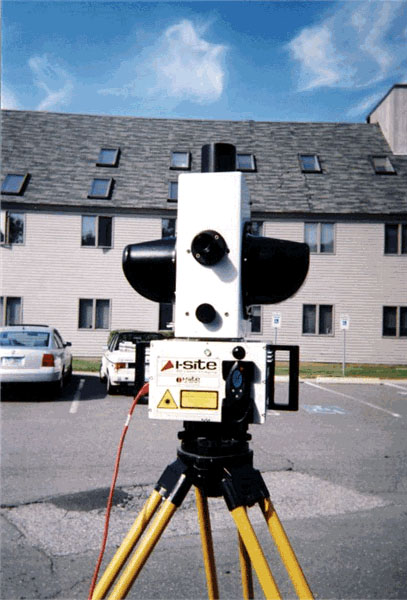
Terrestrial Laser Scanner
Long Range model (4400LR) can scan up to 700m on reflective surfaces.
37 Megapixel camera captures 360 degree by 80 degree photo of the site.
Connectivity:
This instrument uses static ethernet IP to connect to the controller (tablet or laptop) via a crossover ethernet cable. A USB-Ethernet adapter is used on newer tablets that lack RJ45 Ethernet ports.
Windows Network and Sharing > Properties > Local Area Connection
Scroll down to find Internet Protocol Version 4 (TCP/IPv4)
Static IP: 10.105.8.50
Subnet: 255.255.0.0
Gateway: blank
Preferred DNS: blank
Specifications (from review)
Maptek I-Site 4400LR
Introduced: 2006
Dimensions
Weight: 12kg + 2kg battery
Size: 43.cmx27.1cm x 35.6cm
Power: Removable battery
Battery: Internal, removable rechargeable via car/main charger
Laser Ranger
Range mensurement principal: Pulsed
Wavelength: 905nm
Laser safety class: 3R
Min/Max range (m): 5m/700m
Range resolution: mm
Range accuracy at 50m (1 sigma): 20mm
Beam diameter at exit: 20mm
Beam divergence/spot at 50m: 1.4/70mm
Scanning characteristics
Max. field of view: 80°x360°
Scan angle step size: 0.108°
Scan angle accuracy: 0.04°
Beam deflection mechanism: Rotating mirror with azimuth stepping Measurement rate: 4.4kHz
Scan duration (typical/highest): 4/12.5
Selection of scan: Graphical interface
Operation characteristics
Temperature range/humidity: 0°C-50°C (-40°C-50°C with heated battery)
Internal camera: Y
Inbuilt control panel: Via Tablet PC
Scan time per battery: 3 hours
Main application area: Long-range open pit and site survey, Highwall positioning and geological mapping, Stockpile survey
for volume calculations and reconciliation, Volumetric analysis of truck loads, Monitoring of site stability and erosion control
Peripherals
Camera: Integrated 37 MPixel
Export format for image: JPEG
User interface: Integrated tablet PC 1 Gb/Win XP
Additional Sensors: Integrated dual-axis level compensator
Software functionality
Software: Maptek I-Site Studio
Registration method: Conventional surveying; matching surface feature/ points; N-point; underground boom-frame
Automatic detection of tie points: Y (reflector identification)
Integration of data from different scans: Y
Real-time visualization: N
Fly around, pan and zoom: Y
Georeferencing: Y
Point (group) selection: Y
Fitting of primitives: Y - Line, plane, circle
Largest model: 22 million points
Export formats of processed data: 3DP, OBJ, DXF, DXB, VRML, 3DI, 00T, TXT, ASC, DWG, DGD, ARCH_D, JPG, IREG, MA, 3DV
Import formats: 3DP, OBJ, DXF, DXB, 3DV, 3DD, 4DD, RSP, IXF, PTX, 3DI, 00T, TXT, ASC, DWG, DGD, ARCH_D, DGD.ISIS, ZFS


