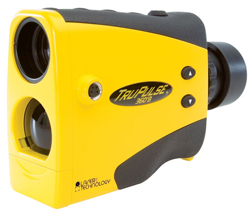
This instrument was originally purchased to use in conjunction with ESRI ArcPad on a Windows Mobile device. With the deprecation of Windows Mobile this instrument is best used with Lasertech MapSmart for Android.
The APK for the older MapSmart v5.3 is available for use on Android 7 and 8 devices.
The TruPulse 360 B offers all the same functionality as the standard 360 model, but this laser has Bluetooth® capabilities for wireless data collection. This model is also available yellow, tan and grey. Some features include:
- Capable of wireless data connection
- Measures HD, VD, SD, INC, HT, AZ and ML
- 3-shot height routine & 2-shot missing line routine
The TruPulse 360 takes two AA batteries.
This instrument needs to be calibrated periodically as demonstrated in a video with a link on the right side of this webpage
http://www.lasertech.com/TruPulse-360-B-Specifications.aspx#
Hardware Specifications:
| Weight: | 8 ounces (220 g) |
| Size: | 5" x 2" x 3.5" (12 cm x 5 cm x 9 cm) |
| Data Com: | Serial, via wired RS232 (standard) or wireless Bluetooth® (optional with 200B model) |
| Max Range: | 0 to 3,280 ft (1,000 m) typical; 6,560 ft (2,000 m) max to reflective target |
| Range Accuracy: | +/- 1 ft (+/- 30 cm), high quality target +/- 1 yd (+/- 1 m), low quality target |
| Inclination Accuracy: | +/- 0.25 degrees |
| Power: | 3.0 volts DC nominal; (2) AA batteries (Alkaline, NiCd/NiMH, Lithium) or (1) CRV3 battery |
| Battery duration: | AA approx 43,000 measurements (37,000 w/ Bluetooth® enabled); CRV3 approx – 86,000 measurements (74,000 w/ Bluetooth® enabled) |
| Eye safety: | FDA Class 1 (CFR 21) |
| Environmental: | Impact, water and dust resistant; NEMA 3, IP 54 |
| Temperature: | -4°F to +140°F (-20°C to +60°C) |
| Optics: | 7X magnification (field of view: 330 ft @ 1,000 yds) |
| Display: | In-scope LCD |
| Units: | Feet, Yards, Meters, and Degrees |
Measurement Solutions:
- Distance (Horizontal, Vertical, Slope)
- Inclination (Degrees and Percent Slope)
- Height (Flexible three-shot routine)
- Azimuth (Compass bearing for single-shot positioning)
- Missing Line (Distance, Inclination and Azimuth between any two remote points)
Measurement Range:
- Distance: 0 to 3,280 ft (1,000 m; typical, 6,560 ft (2,000 m) max to reflective target
- Inclination: ±90 degrees
- Azimuth: 0 to 359.9 degrees
Accuracy:
- Distance: ±1 ft (±30 cm) typical, ±1 yd (±1 m) to low quality targets
- Inclination: ±0.25 degrees
- Azimuth: ±1 degree; typical
Target Modes: Standard, Closest, Farthest, Continuous, and Filter
Useful tutorials online here
http://surveying-mapping.duncan-parnell.com/GPS-Mapping-Support.html


