


This workshop picks up from the field instrument workshops focusing on GNSS and Total Station mapping. Data collected with instruments and exported as a CSV table is brought into QGIS for mapping purposes. There is a walk through video on the ARF Channel showing the steps we will cover in this workshop.
In order to be most useful to the participants the workshop will be held in-person and you're encouraged to prepare a map of your own research area at a scale useful to current work. Please bring a laptop with a copy of QGIS 3 installed for your platform.
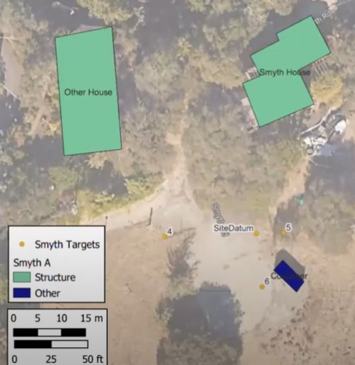
In this basic Site Map workshop we demonstrate how to bring in mapped points from a spreadsheet (CSV) which is how data is generally transferred from total station or GNSS unit. Next we discuss digitizing on screen using the Create and Edit polygon tools. We'll discuss how to use the Attribute Table for storing Labels and Categories for styling the map.
We also talk about the the Layout tools which include the Legend, Scale bar, North Arrow. This is distinctive from ESRI products so if you're coming from ArcMap or ArcPro you'll want to focus on this section in particular.