


This workshop demonstrates various uses of georeferencing in QGIS and its utility in archaeological research. Georeferencing is the act of placing images, scans, or other raster data into an explicit geographical reference system so that it spatially registers correctly with other data sets.
Please see these videos for the content of this workshop
How to georeference and clip geophysical data in QGIS 3.x
and
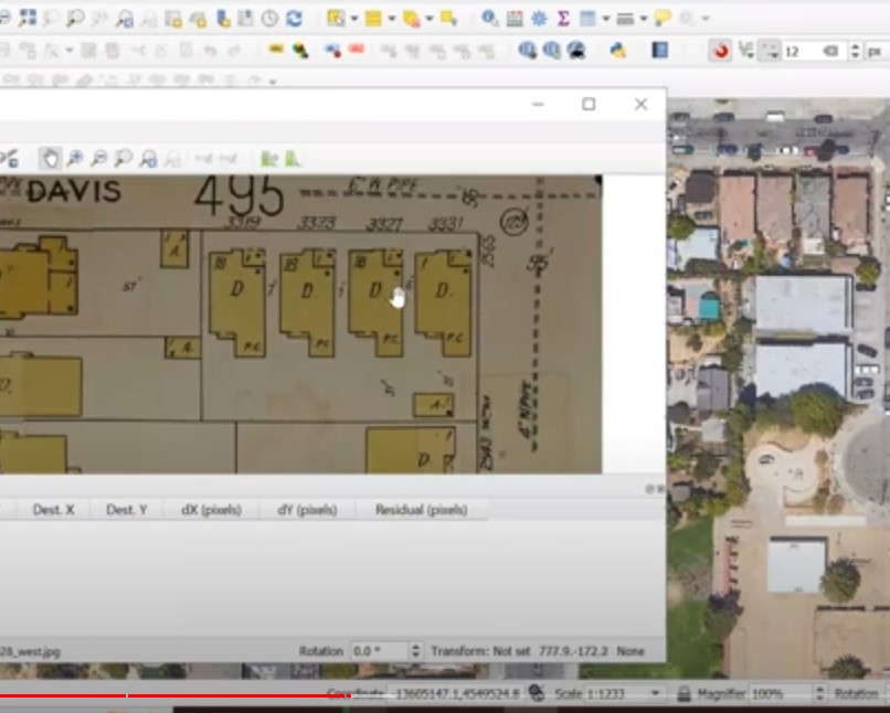
Bringing a Sanborn Historical Map and Census data into QGIS 3.x
Georeferencing can also be used with vector files as well (these are objects such as shapefile point, lines and polygons). Note: that as of version 3.28 in 2022 QGIS recently moved the Georeferencer... from the Raster menu to the Layer menu because it can now handle Vector data as well.
In ArcGIS products Georeferencing refers to placing Raster data while Spatial Adjustment toolbar is used with Vector data.