


Photogrammetry is an broad set of techniques that is now often used in combination with laser scanning for the production of high resolution 3-D models. At root, photogrammetry involves combining many overlapping photos where the camera position moves (structure from motion), generating a rich product that may include 3-D data or a seamless stitched single image. This workshop focuses on the photogrammetry side (not laser scanning).
Of particular interest to archaeologists are categories that include producing:
- models of objects
- models of larger features, like architectural structures
- documenting parietal art with high-quality photos stitched together, as well as producing a model
- 3-D terrain data from a drone or pole-mounted camera.
In this workshop, we use AGISoft Metashape Pro and also demonstrate the open source software WebODM (Open Drone Map).
The USGS recommended workflow for Metashape 1.6 is particularly valuable for this scientific photogrammetry approach.
Workshop Goals
This workshop begins with a discussion of photography principles for model capture. This involves taking photos of an object using a Canon EOS6D dSLR and a 50mm lens, CHI scale rulers, and a green screen. After downloading the images, students begin processing them in AGISoft Metashape 1.85. After discussing workflow, masking, and error reduction, the course focuses on using the Assign Targets and Create Scalebars tools to scale and optimize the image. In addition, the workshop provides resources for troubleshooting in Metashape, including how to share the results by exporting steps and how to proceed depending on the goals of the model (e.g., web viewing, terrain analysis, 3d printing, instructional replicas).
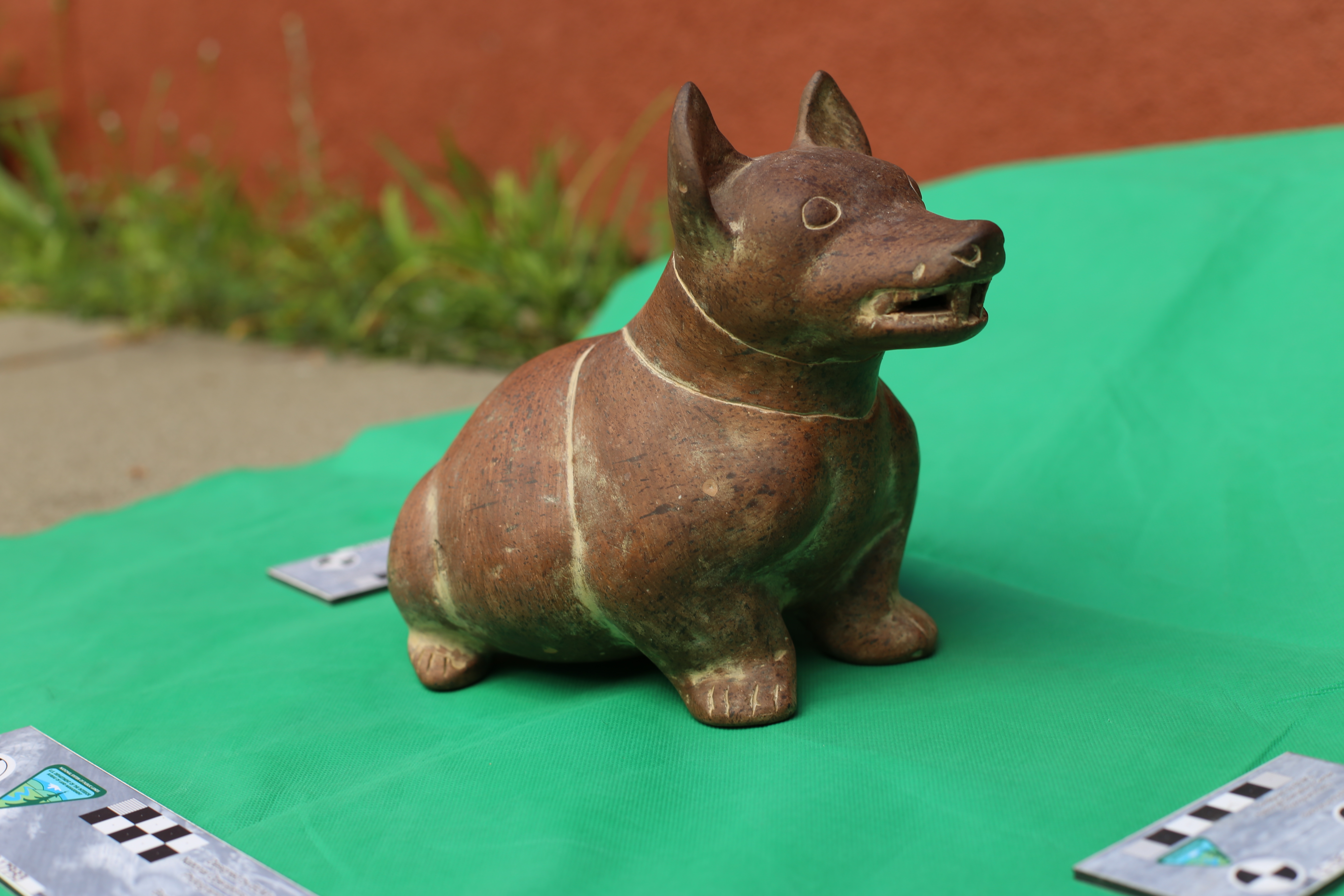
Students also learn to export models to PDF and FBX, as well as how to import into Sketchfab for sharing online. (See this replica Colima dog ceramic as an example of a sketchfab model.)
Finally, we will discuss drone photogrammetry and briefly view an instance of WebODM.
PDF Export from Metashape is a good way to distribute 3-D data to audiences that do not have dedicated 3-D software installed.
During the 2023 workshop, students photographed a fuzzy Oski bear statue, and this model was exported to 3-D PDF (attachment below). (Note that Acrobat Reader can open this model, but will likely require that support be enabled from the 3-D PDF.
Resources
AGISoft Metashape Tutorials, KnowledgeBase and User forums
Cultural Heritage Imaging discussion
YouTube (many tutorials of variable quality)
Digital Photography Cheatsheet PDF (a brief overview of ISO / Shutter speed / Aperture relationship)
Introduction to Photogrammetry (2020) by Sasanka Madawalagama. (This lengthy presentation is a PDF with 100 slides on the history of orthorectification and drone mapping. It uses Pix4D photogrammetry.)
USGS Report on Metashape 1.6 detailed workflow for mapping of coastal environments with UAV images